Overview
This route provides the opportunity to “trek high and sleep low” which is considered important in minimizing the potential for altitude sickness.
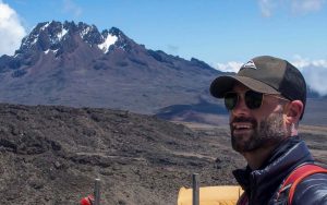
The climb starts above the picturesque mountain village of Machame to the south of Kilimanjaro. After passing through the Machame forest and into the moorland zone, we scramble up and over some rocks and eventually emerge onto the Shira Plateau. We then advance counter-clockwise traversing below the southern face of Kibo, climb Lava Tower for magnificent 360 degree panoramas, ascend the Great Barranco Wall, a challenging and exhilarating rock scramble, and approach Uhuru Summit from Barafu or Kossovo Camp and the ridge that abuts the Southeast Valley. The climb from Barafu offers incredible views of Mawenzi Peak and Kilimanjaro’s remnant volcanic cone.
| Number of Climbers | Price (USD) |
|---|---|
| 1 person | $2250 |
| 2-4 people | $1950 |
| 5-7 people | $1800 |
| 8 or more | $1650 |
Tour Plan
Day 1 : Arival in Tanzania
As you walk out of Kilimanjaro International Airport, an Africa Climber Adventures representative will be there to transfer you to your hotel, where you can relax and take in the African atmosphere.
Preparation for your climb: Before the start of your climb, you will meet your guide, who will brief you and provide advice on what to wear, what to pack, and other essential tips to ensure a comfortable and successful climb.
Day 2 : Hotel-Machame Gate to Machame Camp
Hiking Time:6-7 hours
Total Distance:8.2 km
Starting Altitude: 1829m (6,000ft)
Final Altitude:3030m (9,950ft)
Environment:Montane (rain) Forest
Depart Machame Gate and trek upwards through the montane rainforest, characterized by dense vegetation,a muddy trail and short sections of steep climbs where you may hear the calls of many exotic birds and if we are lucky we may see blue monkeys on the forest canopy and hear the grunting calls of the magnificent black colobus monkeys with their long ‘cape’ of white hair and a flowing white tail.
Our first campsite, Machame Camp, is right after the dense tree cover in an area with lower but still thick bush where Podocarpus (African yellow-wood), Hagenia and Hypericum (St John’s Wort) dominate. In the evening you may hear the unmistakable shrieking call of the tree hyrax.
Day 3 : Machame Camp to Shira Cave
Hiking Time:7-8 hours
Total Distance:5 km
Starting Altitude: 3030m (9,950ft)
Final Altitude:3840m (12,600ft)
Environment: Moorland
Today we continue through increasingly sparse trees and bushes into moorlands. Picturesque hanging mosses often cover trees offering an ethereal quality to the landscape. The day finishes with Shira Camp, which is on a small plateau in the high moorlands, and features views of Kibo in the northwest and Mount Meru towards the east. White necked ravens can be seen throughout the day and around our campsite.
Day 4 : Shira Cave to Barranco Camp
Hiking Time:6-7 hours
Total Distance:7 km
Starting Altitude: 3840m (12600ft)
Final Altitude:4642m (15230ft)
Environment:Semi-Alpine Desert
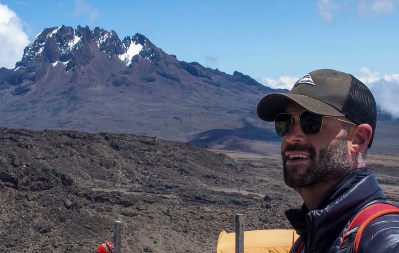
Today we turn east and continue to climb “pole pole” (slowly, slowly) through increasingly rocky and desolate terrain. We will leave the moorland behind and continue up a rocky path through typical Kilimanjaro mountain vegetation of Senecios and Lobelia. We will pass through the alpine moorland zone where plants are extremely hardy and consist of lichens, grasses, and heather, to reach Kilimanjaro’s alpine desert zone.
We take lunch at Lava Tower (4630m) and for those who feel up to it you can undertake an optional rock scramble (non technical) to the top of Lava Tower where you will have spectacular panoramic vistas of the Karanga Valley below, Shira Plateau and the spectacular Western Breach above.
From Lava Tower, we descend steeply for 2 hours down more than 600m into the Great Barranco Valley. This descent affords fantastic views and some great photo opportunities of the Western Breach and Breach Wall. You will also feel the clear benefits of this acclimatization day as we lose altitude down to the camp.
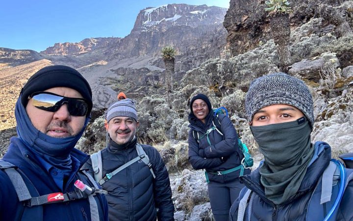
Barranco Camp is set on a col (flat area) enclosed on three sides by the Breach Walls, and the Kibo massif itself. Hanging glaciers shimmer in the sunshine above amidst the eerie landscape of plants such as the giant groundsels, and the uniquely endemic Giant Lobelia. This is definitely the toughest day so far, but incredibly beautiful.
Meals Plan: Breakfast, Lunch, Dinner
Day 5 : Baranco Camp to Barafu Camp
Today’s Stats
Hiking Time:6-7 hours
Total Distance: 11.4 km
Starting Altitude: 3978m
(13054ft)
Final Altitude:4600m (15200ft)
Environment:Alpine Desert
Today we undertake the Great Barranco Wall – an imposing face above Barranco camp. A steady climb up the eastern wall takes us just below the Heim Glacier, where we may have some breathtaking views of the Heim Glacier and Mt. Kilimanjaro depending upon the weather and any cloud cover.
Our trail continues down into the alpine desert of the Karanga Valley. Here the temperature will grow colder as we follow the trail climbing through this barren and dry landscape up to the Barafu camp. Barafu is the Swahili word for “ice”, and the camping area is on a ridge in a narrow and exposed flat area.
Here there are ever-present powerful winds blowing down from the mountain peaks. Our campsite at 4600m offers spectacular views of the nearby peaks of Kibo and Mawenzi.
In preparation for your final ascent tonight, you will familiarize yourself with the terrain before dark, and prepare your equipment and thermal clothing for the summit attempt. Sleep will be difficult, though you will to retire to your tents after dinner to rest for the 1385m final ascent to the roof of Africa.
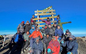
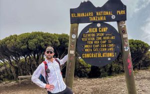
Day 6 : Barafu Camp to Uhuru Peak to Mellenium Camp
Hiking Time:7 hrs to summit, 7-8hrs descent
Total Distance:7km to summit, 23km descent
Starting Altitude: 4682m
Summit Altitude:5895m – Uhuru Peak
Final Altitude:3819m (12530ft)
Environment: Stone Scree, ice capped summit, Alpine desert
We will rise early to leave camp at around 12am and after a warm drink and a light snack, you will begin the most
difficult though most rewarding day of the trek – your hike to the roof of Africa.
After approximately 6 hours of slow but strenuous hiking, you will reach the rim of the main crater, Stella Point, at 5685m.
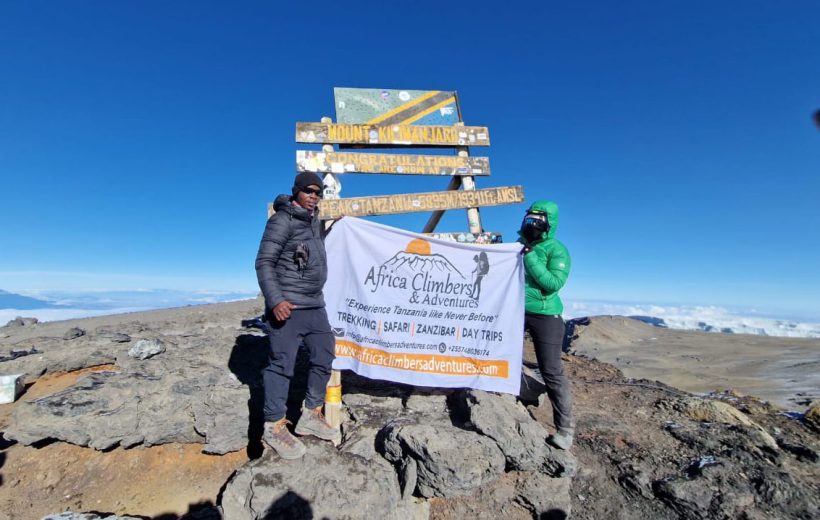
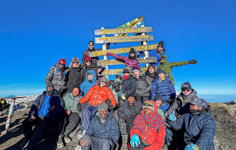
At this point we stop to rest, eat lunch and take in the views over the clouds. From Stella Point the trail is normally snow covered, and every step of the 2-hour final ascent to Uhuru peak is challenging. Passing alongside the iridescent blue Rebmann and Tarzel glaciers we reach Elveda Point (5882) we can see Uhuru Peak now only minutes away. The roof of Africa is within your grasp.
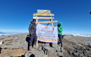
Arriving at the summit you feel a huge sense of elation and accomplishment you have done it, you have made it to the highest point in Africa. We spend as much time as you need to appreciate your accomplishment, as this is a day to remember for the rest of your life! The time you will spend on the summit will depend on the weather conditions and temperature.
We start back down the same trail, and descend to Barafu camp. Here you will have a well earned but short rest and remove some of your many layers of clothing as the day begins to heat up. We head down the rock and scree path into the moorland zone, reaching the forest, and eventually arriving at Millennium Camp in the early afternoon where a hot shower and meal awaits. Today is the longest, and the most mentally and physically challenging of the trek. But a life changing day that will stay with you forever, as you conquered the heights of Kilimanjaro.
Meals Plan: Breakfast, Lunch, Dinner
Day 7 : Mellenium Camp to Mweka Gate-Hotel
Today’s Stats
Hiking Time:5-6 hours
Total Distance:13.5 km
Starting Altitude: 3819m (15530ft)
Final Altitude:1652m (5420ft)
Environment: Montane (rain) Forest
Today your legs will be further tested as the trail descends steeply through the lush Mweka rain forest. The trail is steep in places and the going slippery if wet.
The route follows the crest of a broad ridge separating two river valleys until it meets with a road that leads us for the last 40 mins to the Mweka Park Gates where we stop for a well deserved picnic lunch where successful hikers will receive their summit certificates (gold for Uhuru Peale, Green for Stella point) from the Kilimanjaro National Park Authority. Post celebrations, we are taken by either private bus or Jeep to your hotel in Moshi
Day 8 : Depart Tanzania(Breakfast)
Depart Tanzania or continue your dream with amazing safari extensions.
For trekkers not continuing with a safari we provide transfers to Kilimanjaro International Airport or bus station for your onward journey.
Included/Excluded
- Porterage
- Rescue fee
- Park fees (For non-residents)
- All activities (Unless labeled as optional)
- All accommodation (Unless listed as upgrade)
- Camping equipment
- A professional driver/guide
- All transportation (Unless labeled as optional)
- All Taxes/VAT
- Roundtrip airport transfer
- Meals (As specified in the day-by-day section)
- Drinking water (On all days)
- Climbing gear
- International flights (From/to home)
- Additional accommodation before and at the end of the tour
- Sleeping bag
- Bath towels
- Tips (Tipping guideline US$10.00 pp per day)
- Personal items (Souvenirs, travel insurance, visa fees, etc.)
- Government imposed increase of taxes and/or park fees
Tour Map
Book This Tour
Last Minute Deals
Related Tours